Category:19th-century maps of Thuringia
Jump to navigation
Jump to search
Federal states of Germany:
Subcategories
This category has the following 6 subcategories, out of 6 total.
- 1880s maps of Thuringia (4 F)
- 1890s maps of Thuringia (4 F)
Media in category "19th-century maps of Thuringia"
The following 31 files are in this category, out of 31 total.
-
 Leuchtenburg Historische Flurkarte.jpg 4,000 × 3,000; 3.65 MB
-
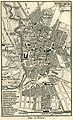
_p468_Plan_der_Grossherzoglichen_Residenzstadt_Weimar.jpg/120px-BECHSTEIN(1844)_p468_Plan_der_Grossherzoglichen_Residenzstadt_Weimar.jpg) BECHSTEIN(1844) p468 Plan der Grossherzoglichen Residenzstadt Weimar.jpg 4,666 × 3,022; 6.82 MB
BECHSTEIN(1844) p468 Plan der Grossherzoglichen Residenzstadt Weimar.jpg 4,666 × 3,022; 6.82 MB
-
 Die Sächsischen Anhaltischen u Schwarzenburgischen Länder Platt 1848.pdf 2,977 × 2,375; 767 KB
-
 Sachsen-Meiningen-1849-detail.jpg 534 × 562; 45 KB
-
 1850 Gera Cuba.jpg 464 × 358; 204 KB
-
 Mertendorf 1855 rechts.JPG 1,166 × 817; 200 KB
-
 Fürstentümer Reuß 1894.jpg 1,165 × 1,344; 1.02 MB
-
_Plan_der_Stadt_Erfurt_im_14.Jh.jpg/109px-KIRCHHOFF(1870)_Plan_der_Stadt_Erfurt_im_14.Jh.jpg) KIRCHHOFF(1870) Plan der Stadt Erfurt im 14.Jh.jpg 3,167 × 3,487; 5.41 MB
KIRCHHOFF(1870) Plan der Stadt Erfurt im 14.Jh.jpg 3,167 × 3,487; 5.41 MB
-
_Übersichtskarte_von_Mittelthüringen.jpg/120px-KIRCHHOFF(1870)_Übersichtskarte_von_Mittelthüringen.jpg) KIRCHHOFF(1870) Übersichtskarte von Mittelthüringen.jpg 3,081 × 2,816; 4.12 MB
KIRCHHOFF(1870) Übersichtskarte von Mittelthüringen.jpg 3,081 × 2,816; 4.12 MB
-
_Plan_der_hochfürstl._Residenzstadt_HILDBURGHAUSEN.jpg/120px-GROBE(1871)_Plan_der_hochfürstl._Residenzstadt_HILDBURGHAUSEN.jpg) GROBE(1871) Plan der hochfürstl. Residenzstadt HILDBURGHAUSEN.jpg 2,774 × 2,186; 2.46 MB
GROBE(1871) Plan der hochfürstl. Residenzstadt HILDBURGHAUSEN.jpg 2,774 × 2,186; 2.46 MB
-
 1880 Culmitzsch.jpg 661 × 585; 365 KB
-
.jpg/120px-Schlacht_bei_auerstädt_(14.10.1806).jpg) Schlacht bei auerstädt (14.10.1806).jpg 744 × 454; 146 KB
Schlacht bei auerstädt (14.10.1806).jpg 744 × 454; 146 KB
-
 Stadtplan Ilmenau 1890.jpg 2,208 × 1,592; 3.21 MB
-
 Thuringische staaten1890.jpg 4,767 × 3,222; 7.42 MB
-
 Stielers Handatlas 1891 14.jpg 5,099 × 4,000; 7.38 MB
-
 Ortskarte von Gräfentonna 1892.jpg 2,435 × 1,857; 2.61 MB
-
_Karte_zur_Verbreitung_der_Hermunduren_und_Alt-Thüringer.jpg/95px-LERP(1892)_Karte_zur_Verbreitung_der_Hermunduren_und_Alt-Thüringer.jpg) LERP(1892) Karte zur Verbreitung der Hermunduren und Alt-Thüringer.jpg 3,136 × 3,943; 7.43 MB
LERP(1892) Karte zur Verbreitung der Hermunduren und Alt-Thüringer.jpg 3,136 × 3,943; 7.43 MB
-
.jpg/120px-Ausschnitt_aus_dem_Stadtplan_von_Eisenach_mit_Hausnummern_(1892).jpg) Ausschnitt aus dem Stadtplan von Eisenach mit Hausnummern (1892).jpg 1,357 × 704; 317 KB
Ausschnitt aus dem Stadtplan von Eisenach mit Hausnummern (1892).jpg 1,357 × 704; 317 KB
-
 Erfurt Map 1894.jpg 1,567 × 2,054; 1,011 KB
-
 Thuringia 1894 political overview.jpg 2,332 × 1,796; 1.41 MB
-
 Weimar map 1894.jpg 969 × 1,595; 496 KB
-
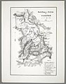
_Karte_vom_Amt_Hallenberg.jpg/120px-KÖBRICH(1894)_Karte_vom_Amt_Hallenberg.jpg) KÖBRICH(1894) Karte vom Amt Hallenberg.jpg 2,277 × 1,533; 2.95 MB
KÖBRICH(1894) Karte vom Amt Hallenberg.jpg 2,277 × 1,533; 2.95 MB
-
_Die_alte_Stadtbefestigung_(Eisenachs)_p35.jpg/120px-PETER(1896)_Die_alte_Stadtbefestigung_(Eisenachs)_p35.jpg) PETER(1896) Die alte Stadtbefestigung (Eisenachs) p35.jpg 3,646 × 2,618; 6.47 MB
PETER(1896) Die alte Stadtbefestigung (Eisenachs) p35.jpg 3,646 × 2,618; 6.47 MB
-
 Bataille De Jena Ou D'Auerstedt du 14 Octobre 1806.jpg 4,758 × 6,286; 9.09 MB
-
_(14597904259).jpg/112px-Brockhaus%27_Konversations-Lexikon_(1892)_(14597904259).jpg) Brockhaus' Konversations-Lexikon (1892) (14597904259).jpg 2,443 × 2,625; 1.67 MB
Brockhaus' Konversations-Lexikon (1892) (14597904259).jpg 2,443 × 2,625; 1.67 MB
-
 Carte des Etats de Thuringe - Duché de Saxe-Cobourg et Gotha - 1893.jpg 5,539 × 3,910; 7.34 MB
-
 Darstellung des Gefechts bei Saalfeld den 2ten April 1761.jpg 5,457 × 6,927; 8.88 MB
-
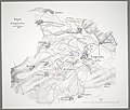 Gefecht bei Langensalza am 15ten Februar 1761.jpg 7,620 × 6,498; 10.67 MB
-
 Karte Jena von seinem Ursprunge 1858.jpg 2,480 × 2,153; 986 KB
-
 Plan der Gegend um Erfurt in 1-25 000 - entworfen von J. F. von Zittroitz - btv1b53257983s.jpg 12,010 × 8,572; 21.98 MB
-
 Übersichtskarte von West-Thüringen mit Straßen und Territorialgrenzen.jpg 2,267 × 3,000; 668 KB

_p468_Plan_der_Grossherzoglichen_Residenzstadt_Weimar.jpg)


_Plan_der_Stadt_Erfurt_im_14.Jh.jpg)
_Übersichtskarte_von_Mittelthüringen.jpg)
_Plan_der_hochfürstl._Residenzstadt_HILDBURGHAUSEN.jpg)

.jpg)


_Karte_zur_Verbreitung_der_Hermunduren_und_Alt-Thüringer.jpg)
.jpg)


_Karte_vom_Amt_Hallenberg.jpg)
_Die_alte_Stadtbefestigung_(Eisenachs)_p35.jpg)

_(14597904259).jpg)


