Category:19th-century maps of Saxony
Jump to navigation
Jump to search
Federal states of Germany:
Subcategories
This category has the following 17 subcategories, out of 17 total.
Media in category "19th-century maps of Saxony"
The following 18 files are in this category, out of 18 total.
-
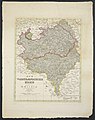 Der Voigtlaendische Kreis 1829.jpg 4,640 × 5,845; 8.15 MB
-
_Das_Siedlungsgebiet_der_Sorben_vom_7._bis_11._Jahrhundert_in_Mitteldeutschland.jpg/120px-BOGUSŁAWSKI(1861)_Das_Siedlungsgebiet_der_Sorben_vom_7._bis_11._Jahrhundert_in_Mitteldeutschland.jpg)
-
_Das_Siedlungsgebiet_der_Sorben_im_19._Jahrhundert_in_der_Lausitz.jpg/120px-BOGUSŁAWSKI(1861)_Das_Siedlungsgebiet_der_Sorben_im_19._Jahrhundert_in_der_Lausitz.jpg) BOGUSŁAWSKI(1861) Das Siedlungsgebiet der Sorben im 19. Jahrhundert in der Lausitz.jpg 4,872 × 4,148; 8.85 MB
BOGUSŁAWSKI(1861) Das Siedlungsgebiet der Sorben im 19. Jahrhundert in der Lausitz.jpg 4,872 × 4,148; 8.85 MB
-
 Diebesgraben.jpg 1,200 × 1,200; 1.31 MB
-
 Feldzug von 1757. Dritte Periode A. Feldzug in Sachsen, von Ende Aug. bis zum 5ten Novbr.jpg 7,004 × 5,300; 5.53 MB
-

-
 Feldzug von 1759.jpg 7,932 × 5,414; 6.47 MB
-
 Grundriß Plauenscher Grund 1812.jpg 4,889 × 1,818; 1.37 MB
-
 Grundriß Tharandt 1812.jpg 2,657 × 2,078; 1.14 MB
-
 Karte der Sächsisch-Schlesischen Eisenbahn.jpg 14,331 × 5,789; 14.39 MB
-
 Operations-Karte zum Feldzuge des Jahres 1761 in Sachsen.jpg 7,019 × 5,322; 4.4 MB
-
 Operations-Karte zum Feldzuge von 1760 in Sachsen u. Schlesien gehörig.jpg 10,382 × 8,389; 6.37 MB
-
 Schulkarte vom Königreich Sachsen.jpg 3,143 × 2,818; 3.13 MB
-
 Section Chemnitz.jpg 6,834 × 5,973; 12.58 MB
-
 Section Dresden.jpg 6,834 × 6,019; 13.03 MB
-
 Stellung der Preuss. Armee hinter der Triebsche, im Jahr 1761.jpg 8,433 × 8,555; 7.82 MB
-
.jpg/120px-Umgegend_von_Plauen_(1761).jpg) Umgegend von Plauen (1761).jpg 3,391 × 2,572; 2.76 MB
Umgegend von Plauen (1761).jpg 3,391 × 2,572; 2.76 MB
-
 Übersichts-Karte für den Marsch des Königs aus Sachsen nach Schlesien Anfangs May 1761.jpg 6,934 × 5,296; 4.16 MB

_Das_Siedlungsgebiet_der_Sorben_vom_7._bis_11._Jahrhundert_in_Mitteldeutschland.jpg)
_Das_Siedlungsgebiet_der_Sorben_im_19._Jahrhundert_in_der_Lausitz.jpg)


.jpg)
