Category:19th-century maps of Prussia
Jump to navigation
Jump to search
Subcategories
This category has the following 9 subcategories, out of 9 total.
- 1810s maps of Prussia (14 F)
- 1820s maps of Prussia (3 F)
- 1830s maps of Prussia (8 F)
- 1880s maps of Prussia (4 F)
- 1890s maps of Prussia (15 F)
Media in category "19th-century maps of Prussia"
The following 19 files are in this category, out of 19 total.
-
 Das Fürstenthum Breslau, oder der Breslausche Und Neumarcktsche Kreis.jpg 10,032 × 6,976; 24.03 MB
-
 Szyski Gilly.jpg 1,063 × 1,006; 497 KB
-
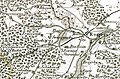
 Tilsit-Ragnit-Baublen.jpg 3,168 × 4,713; 3.64 MB
-
 Swierczynsko mapa Gilly.jpg 785 × 517; 617 KB
-
 Charte vom Königreiche Preussen oder Ost- West- Süd Und Neu- Ost-Preussen.jpg 8,382 × 6,966; 17.88 MB
-

-
 Robert Wilkinson - Prussia.pdf 13,875 × 11,808; 5.06 MB
-
 Periode der Verluste.jpg 1,613 × 2,472; 1.28 MB
-
.jpg/120px-119_of_%27Die_Hohenzollern_und_das_Reich%2C_etc%27_(11171344114).jpg) 119 of 'Die Hohenzollern und das Reich, etc' (11171344114).jpg 2,544 × 1,701; 1.2 MB
119 of 'Die Hohenzollern und das Reich, etc' (11171344114).jpg 2,544 × 1,701; 1.2 MB
-
%27_(11173032074).jpg/79px-624_of_%27(The_Gallery_of_Geography%2C_a_pictorial_and_descriptive_tour_of_the_world.)%27_(11173032074).jpg)
-
%27_(11172070595).jpg/79px-625_of_%27(The_Gallery_of_Geography%2C_a_pictorial_and_descriptive_tour_of_the_world.)%27_(11172070595).jpg)
-
 Meyers b12 s0541a.jpg 2,048 × 1,647; 896 KB
-
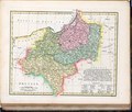
 Preussen-1806.jpg 1,000 × 502; 187 KB
-
 BV042518398.tif 4,937 × 6,732; 47.51 MB
-
 Preußen 1688 1806 1815 1866.jpg 1,479 × 1,175; 466 KB
-
.jpg/120px-267_of_%27Overzicht_der_algemeene_en_vaderl._geschiedenis%2C_met_20_historische_Kaarten%2C_voor_de_hoogere_Klassen%2C_etc%27_(11221018135).jpg)
-
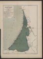
 A chart of Prussia and Coerland from Rygshead to der Winda - btv1b5973491q.jpg 7,408 × 5,928; 6.77 MB
-
 Meyers b13 s0363a.jpg 2,048 × 1,754; 773 KB
-
 Prussia from Court Game of Geography MET DP862883.jpg 806 × 1,200; 343 KB


.jpg)
%27_(11173032074).jpg)
%27_(11172070595).jpg)


.jpg)


