Category:19th-century maps of Poland
Jump to navigation
Jump to search
Subcategories
This category has the following 12 subcategories, out of 12 total.
- 1810s maps of Poland (20 F)
- 1820s maps of Poland (7 F)
- 1860s maps of Poland (12 F)
- 1870s maps of Poland (5 F)
- 1880s maps of Poland (19 F)
*
Media in category "19th-century maps of Poland"
The following 9 files are in this category, out of 9 total.
-
 1878 map of Warsaw in Polish and Russian.jpg 10,034 × 12,370; 22.28 MB
-
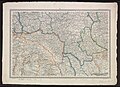 Central Eastern Europe; 5th map of unidentified Russian map series.jpg 13,101 × 9,531; 14.63 MB
-
.jpg/117px-288_of_%27Onze_aarde._Handboek_der_natuurkundige_aardrijkskunde_..._Met_150_platen_en_20_kaartjes_in_afzonderlijken_Atlas%27_(11286534326).jpg)
-
 Austriacka mapa Wiszniowa z 1876 r.jpg 1,088 × 789; 290 KB
-
 Brzostek BV043906670.jpg 11,360 × 8,864; 22.7 MB
-
 Mapa topograficzna rejonu warszawskiego z 1875 r., fragment.jpg 865 × 667; 198 KB
-
 Schlacht bei Kunersdorf am 12ten August 1759.jpg 6,290 × 5,330; 8.97 MB
-
 Włocin - mapa dóbr ziemskich z 1881 r.jpg 1,738 × 1,890; 414 KB
-
_(cropped).jpg/120px-Podrecznik_geografii_ojczystej_1894_(117388695)_(cropped).jpg) Podrecznik geografii ojczystej 1894 (117388695) (cropped).jpg 3,001 × 2,221; 1.29 MB
Podrecznik geografii ojczystej 1894 (117388695) (cropped).jpg 3,001 × 2,221; 1.29 MB


.jpg)


_(cropped).jpg)