Category:1850s maps of Ukraine
Jump to navigation
Jump to search
Subcategories
This category has the following 3 subcategories, out of 3 total.
- 1854 maps of Ukraine (4 F)
- 1855 maps of Ukraine (23 F)
1
Media in category "1850s maps of Ukraine"
The following 13 files are in this category, out of 13 total.
-
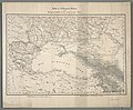 Karte des Schwarzen Meeres.jpg 5,709 × 4,732; 8.07 MB
-
 Südukraine - Nordkrim.jpg 3,043 × 3,417; 3.53 MB
-
 Mennonitenansiedlung Molotschna 1852.jpg 2,304 × 1,609; 774 KB
-
.jpg/92px-City_of_Poltava_1857_(cropped).jpg) City of Poltava 1857 (cropped).jpg 5,690 × 7,433; 3.84 MB
City of Poltava 1857 (cropped).jpg 5,690 × 7,433; 3.84 MB
-
 City of Poltava 1857.jpg 5,756 × 8,012; 3.97 MB
-
 1859. Катеринославська губернія.jpg 1,146 × 863; 214 KB
-
 Henichesk Rayon in Maps created by Schubert in 1859.jpg 1,000 × 1,000; 187 KB
-
 Мапа Херсонскої Губернії 1859 рік.jpg 3,944 × 2,954; 3.91 MB
-
 Storonevychi map 2.jpg 3,077 × 2,476; 1.12 MB
-
 Storonevychi map 3.jpg 3,341 × 2,718; 1.69 MB
-
 Storonevychi map 4.jpg 3,352 × 2,021; 1.09 MB
-
 Мапа де позначено Рогатин та Пуків 1855 року.jpg 2,000 × 1,000; 1.15 MB
-
 Церква Святої Марії.jpg 2,065 × 1,494; 968 KB


.jpg)


