Category:1850s maps of Romania
Jump to navigation
Jump to search
Media in category "1850s maps of Romania"
The following 8 files are in this category, out of 8 total.
-
 Meyer‘s Zeitungsatlas 085 – Europäische Türkei- Rumelien, Bulgarien und Walachei.jpg 7,323 × 6,231; 16.32 MB
-
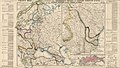
_MAP_OF_LOWER_DANUBIA.jpg/120px-(1853)_MAP_OF_LOWER_DANUBIA.jpg) (1853) MAP OF LOWER DANUBIA.jpg 3,131 × 2,568; 3.47 MB
(1853) MAP OF LOWER DANUBIA.jpg 3,131 × 2,568; 3.47 MB
-
 1854 map of the Eastern Balkan peninsula during the Crimean War.jpg 5,959 × 8,500; 14.99 MB
-
_-_detail_1.jpg/120px-Karte_des_Grossfürstentums_Siebenbürgen_nach_der_definitiven_politischen_%26_gerichtlichen_Landeseintheilung_(BL_Maps_33710.2)_-_detail_1.jpg)
-
 The Danubian Principalities, Prepared From The Vienna Map in 21 Sheets.jpg 32,510 × 33,257; 302.33 MB
-
-

-
_With_numerous_maps_and_notes%27_(11110682553).jpg/76px-thumbnail.jpg)

_MAP_OF_LOWER_DANUBIA.jpg)

_-_detail_1.jpg)


_With_numerous_maps_and_notes%27_(11110682553).jpg)