Category:1850s maps of France
Jump to navigation
Jump to search
Subcategories
This category has the following 11 subcategories, out of 11 total.
- 1850 maps of France (23 F)
- 1851 maps of France (10 F)
- 1852 maps of France (107 F)
- 1853 maps of France (19 F)
- 1856 maps of France (22 F)
'
Media in category "1850s maps of France"
The following 5 files are in this category, out of 5 total.
-
 1850 - Progrès des congréganistes en France 1866 - par J. Manier - btv1b53102955w.jpg 8,739 × 6,902; 8.39 MB
-
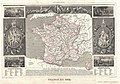 1852 Levasseur Map of France - Geographicus - France1852-levasseur-1852.jpg 3,500 × 2,464; 2.86 MB
-

-
 Spanien und Portugal nordöstlicher Teil.jpg 5,531 × 4,502; 8.47 MB
-
.jpg/120px-Carte_du_chemin_de_fer_de_Strasbourg_à_Sarrebourg_-_btv1b10111188v_(1_of_2).jpg) Carte du chemin de fer de Strasbourg à Sarrebourg - btv1b10111188v (1 of 2).jpg 4,826 × 2,178; 2.56 MB
Carte du chemin de fer de Strasbourg à Sarrebourg - btv1b10111188v (1 of 2).jpg 4,826 × 2,178; 2.56 MB


.jpg)